

Tarain Mor [Tarain]
Good walks are even better shared.
Overview
Tarain Mor [Tarain]
Elevation: 791 meters
Location: Central Highlands, Scotland
Introduction
Tarain Mor, affectionately known by locals simply as 'Tarain,' stands proudly in the Scottish Highlands, inviting hikers and nature enthusiasts to explore its scenic trails. This Marilyn offers a moderate challenge for those looking to experience the beauty and ruggedness of Scotland's wilderness.
Geology
The mountain is composed mainly of ancient schists and granites. These geological formations are not only a sight to behold but also a testament to the Earth's history, granting you a glimpse into millions of years of evolution. Take a moment to appreciate the weathered rocks—each one has its own story!
Routes
There are a couple of popular routes to reach the summit:
Eastern Approach: This gentle ascent makes for a great starter hike. With a distance of about 5 km and an estimated 2.5 hours to reach the top, it’s perfect for families and novice hikers.
Northern Ridge: For those seeking a bit more adventure, the Northern Ridge offers a spectacular route with some more challenging sections. Approximately 4 km long and taking around 3 hours, the views along the way are worth every ounce of effort.
Summit Features
Upon reaching the summit, you'll be greeted by a reassuring cairn and a trig point, signifying your achievement. Don't forget to snap a few photos to make your friends green with envy!
Terrain Type
Expect a mixture of rocky outcrops, vibrant patches of heather, and grassy clearings. While navigating this stunning terrain, be mindful of the occasional boggy patches—Scotland's answer to natural ankle biters!
Views
From Tarain Mor's summit, the panoramas are truly magnificent. Highland peaks stretch out in all directions, making it the perfect lookout point. On a clear day, you might even catch a glimpse of the famed Ben Nevis, standing tall in the distance.
- Best Seasons for Views: Spring and autumn are prime times to visit, with blooming heather and breathtaking autumnal colours. If you're brave enough to venture in winter, clear days can offer stunning landscapes—just remember your thermals!
Hazards
As always in the Highlands, be cautious of loose rocks while climbing. The weather can change at the drop of a hat, so pack accordingly and keep an eye on the forecast.
Nearby Summits
If you feel like extending your adventure, nearby summits include:
- Ben Ledi (879 m)
- Ben Vorlich (985 m)
Access
- Nearest Parking: There’s a small car park at the start of the Eastern Approach—arrive early to secure your spot!
- Public Transport: For those relying on public transport, buses from Stirling to Callander run regularly. A quick taxi ride from Callander will drop you at the trailhead.
- Nearest Town: Callander is your go-to spot for any necessary supplies or a cheeky post-hike cup of tea.
Facilities
While the mountain lacks facilities, Callander boasts delightful cafes and public toilets. Always good to know you have a comfort station nearby after a long trek!
History
The name 'Tarain Mor' literally means 'big hill' in Gaelic—a fitting tribute to its impressive stature. This area has been a focal point for local communities for generations, blessed with cultural and natural significance.
Head out and enjoy the outdoor gem that is Tarain Mor!
Explore routes near Tarain Mor [Tarain]
Public walks starting within 80 km of this hill. Nearby does not mean a route reaches the summit; check its map and access before setting out.
Beautiful private beach walk Isle of Harris
View route
Berneray Community Hall to the beautiful beach
View route
Route planning notes
These notes describe possible approaches, not verified navigable routes or permission to cross land. Check current paths, local access rules and conditions before setting out.
Eastern Approach
A straightforward ascent from the east provides a good pathway for first-time hikers, featuring moderate slopes and stunning scenery.
Northern Ridge
This route offers a more adventurous trek along the ridge with breathtaking views, perfect for those who like a bit of a challenge.
Make a day of it, together
Find someone to share the walk with, or organise a day out along a route you like.
Photo Gallery
View all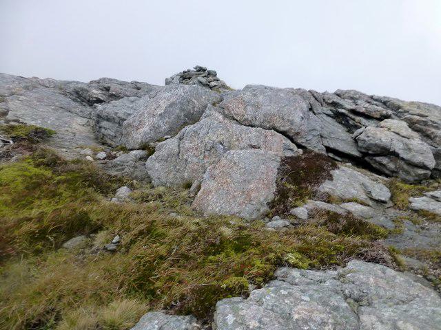 Photo could not load
NB0527 : Tarain [Tarain Mòr]
Rude Health
Hill facts and local notes
Classifications
Elevation
411m
1,348 ft
Prominence
138m
Coordinates
58.1396, -7.0134
NB050277
OS Map
13
Explorer: 458
At the Summit
The summit boasts a classic cairn and a fine trig point, where you can give yourself a pat on the back for making it to the top and take selfies that will make your friends jealous.
Terrain & Geology
The mountain is primarily composed of ancient schists and granites, providing a fascinating insight into the geological past of the region. Look closely, and you might find some beautifully weathered rocks that tell stories spanning millions of years.
Views & Scenery
From the summit, one can admire the majestic peaks of the Central Highlands, including Ben Lebar and the distant silhouette of Ben Nevis on a clear day.
History & Heritage
Name Origin
The name Tarain Mor translates to 'big hill' in Gaelic, which is quite fitting considering its dominant presence in the landscape.
Historical Significance
Historically, the area has been a significant meeting point for local communities and a haven for wildlife, making it a cherished location for both the nature lover and the history buff alike.
Getting There & Facilities
Check current local access restrictions, parking rules and transport timetables before travelling. These notes do not confirm public access to the summit.
Parking
There is a small car park at the foot of the Eastern Approach, providing ample space for a few vehicles. Arrive early as spaces can fill up due to popularity.
Public Transport
Regular buses run from Stirling to the nearby village of Callander, from where the mountain is a 15-minute taxi ride away.
Nearby Facilities
While facilities on the mountain itself are non-existent (bring your own tea and sandwiches!), there are cafes and toilets available in Callander.
Safety Information
Known Hazards
- Loose rocks on the ascent and potential sudden weather changes. Always check the forecast before heading out, as the Scottish weather is notoriously unpredictable!
General Safety Tips
- Check weather conditions before setting out
- Carry appropriate clothing and equipment
- Let someone know your planned route
- Take a map, compass, and GPS device
- Carry emergency supplies: food, water, first aid kit, torch
Hills
Some common questions about the hills answered
Are there group walks up Tarain Mor [Tarain]?
Many walkers use Walkmates to join or organise walks with others. You can check for group walks around Tarain Mor [Tarain] through the maps
Are there other walkers around Tarain Mor [Tarain]?
Activity varies by location and time, but Walkmates lets you see whether others have shared walks or shown interest in this area. Find other people through the walking friends search walking friends for Tarain Mor [Tarain] search or of course create your own walk for Tarain Mor [Tarain]
Can I organise a walk to Tarain Mor [Tarain]?
Yes. If there aren’t any walks listed already, you can create a walk and make it available for others to join.
If you're signed up to Walkmates, you can create a walk to Tarain Mor [Tarain].
How do I find a walk up this hill?
There are often multiple ways to walk this hill, depending on experience and route preference. Walkmates helps you explore walks and routes that others have shared.
Can I suggest a new route up Tarain Mor [Tarain]?
Yes. You can suggest or create routes to share with others. Walkmates focuses on the social side of walking, so routes are used to help people organise walks and explore areas together, rather than as detailed navigation tools or route libraries.
Other uses really appreciate knowledgeable walkers sharing their routes. Share your favourite route to Tarain Mor [Tarain] here
The is an error or something incorrect about this hill. How do I let you know?
We always strive to keep the information on Walkmates as accurate as possible. If you find an error, please let us know through the contact form and we'll aim to correct it as quickly as possible
Community Discussion
Comments
Location
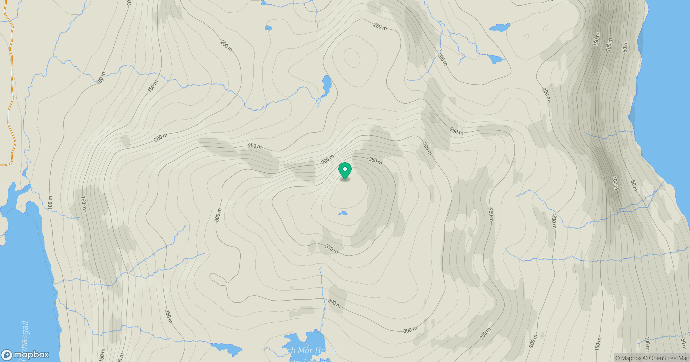
Grid reference: NB050277
View on OpenStreetMapOpens a map in a new tab, centred on the hill.
Hills within 30 km
Straight-line distance, not a walking route or confirmation of access.
No comments yet. Be the first.